Associate Professor
Co-Director, The Roger Tomlinson Lab for GIScience Dept of Geography & School of Environment
Office: Room 412 Burnside Hall
805 Sherbrooke St West
McGill University
Montreal QC H3A0B9 CANADA
Phone:+1 514 398 5316
Email:
My research interests center on Geographic Information Science (GIScience).
I am interested in Agent-Based Models (ABMs), and in the computational aspects
surrounding the implementation of these models to understand both social
and technology related issues.  Recently, I have begun to look at how
machine learning techniques can inform rule-generation for ABMs.

Another aspect of my research looks at the emerging Smart Cities debate.
Current projects in this area look at spatio-temporal variations in Urban Heat
Island (UHI) effect through the use of a large network of low cost sensors.

In the past, I have applied ABMs and advanced Geospatial techniques to study
issues related to Spatial Epidemiology, Landuse-Landcover Change, Payment for
Environmental Services/Conservation Payments and Water Resources Management.
2003-present 	2009-now Associate Professor (tenured);(Leave of Absence 2011-2012)
		2003-2009 Assistant Professor (tenure-track);
		Department of Geography & School of Environment,
		McGill University, Montreal, QC, Canada.
		Associate Member: Computer Science
2011-2012	Associate Professor;
		Indraprastha Institute of Information Techonology-Delhi, India.
2009-2010	Visiting Faculty, Center for Rural Development and Technology,
 		Indian Institute of Technology, Delhi, India (Dec 2009-May 2010)
2009		Visiting Fellow,
		Ashoka Trust for Research in Environment and Ecology (ATREE),
		Bengaluru, India (June 2009-Nov 2009)
2000-2003	Assistant Professor (tenure-track)
		Department of Geography
		Southern Illinois University – Carbondale, Illinois, USA.
1999-2000	Visiting Instructor
		Department of Geography, The University of Iowa, IA, USA.
Ph.D. (2000) Southern Illinois University at Carbondale (Geography)

M.S. (1995) Southern Illinois University at Carbondale (Geology)

M.Sc. (1993) Indian Institute of Technology, Mumbai, India (Applied Geology)

B.Sc. (1991) St. Xaviers College, University of Mumbai, Mumbai, India (Geology)
Editorial Board Memberships:
	Transactions in GIS (2011-2016)
	Water International (2007-2010; 2016-present)

Conference & Workshop committee Memberships:
2018,2016,2012: Member, Program Committee, GIScience (www.giscience.org)
2018:		Organizer, Workshop on Agent-Based Models & Complexity Science
2016:		Local Organization Chair, GIScience 2016
2016: 		Member, Program Committee, CAMUSS 2016
2016: 		Organizer, Workshop on Agent-Based Models & Complexity Science
2007-now:	Member, Program Committee, Spatial Knowledge and Information (SKI).
2007-2010:	Member, Publications Committee, International Water Resources Assoc.
2006-2007:     	Editor, Water International Journal
2007:           Invited Participant, Specialists Meeting on Agent-based Modeling
		of Complex Social Systems (NCGIA)
2005:           Member, Program Committee, XIIth World Water Congress 2005.
2004-2006:      Member, Awards Committee, International Water Resources Assoc.
2003-2005:      AAG Representative, Universities Consortium on GIScience (UCGIS)
2000-2003:      Director, Universities Water Information Network.
Favourites:
Agent-Based Modelling Workshop @ GIScience 2018
GIScience 2018
Spatial Knowledge & Information Canada
American Association of Geographers
Publications
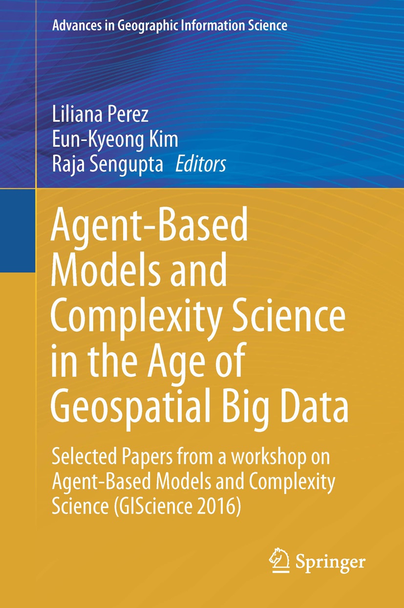
Edited Books:
Perez, L.,
Kim, E.K., and Sengupta, R. (eds),
2017.Agent-Based Models and Complexity Science in the Age of Geospatial Big
Data. Series: Advances in Geographic Information Science Series. Springer
International Publishing, Zurich, Switzerland.
Sarkar, D., Andris, C.
Chapman, C., and Sengupta, R., In Press (2019). Metrics for characterizing Network Structure and Node Importance in
Spatial Social Networks. International Journal of Geographical Information Science https://doi.org/10.1080/13658816.2019.1567736.
Sarkar, D., Chapman, C.,
Valenta, K., and Sengupta, R., In Press (2019). Research stations as conservation instruments provide long term community benefits through social connections. Professional
Geographer .
Bonnell, T., Ghai, R.,
Goldberg, T., Sengupta, R. and Chapman, C., 2018. Simulations of environmentally-transmitted parasites under habitat fragmentation suggests that as habitat is lost, its configuration becomes more important Landscape
Ecology 33(8):1259-1272.
Chapman, C.A., Bortolamiol, S., Matsuda, I.,
Omeja, P.A., Paim, F.P., Reyna-Hurtado, R., Sengupta, R. and Valenta, K., 2018. Primate population dynamics:
variation in abundance over space and time. Biodiversity
and Conservation https://doi.org/10.1007/s10531-017-1489-3.
MacKenzie, C.,S. Moffat, Ogwang, J., Ahabyona, P., and R. Sengupta, 2017. Advocating for
Primary Education: Spatial and Temporal Patterns in Enrolment and Exam
Achievement in Rural Uganda.Children’s Geographies 15(3): 334-348.
Bonnell, T., Chapman, C., and Sengupta,
R., 2016. Interaction between
scale and scheduling choices in simulations of spatial agents. International Journal of Geographic
Information Science, 30(10): 2075-2088.
Bonnell, T.R., Ghai, R.R., Goldberg, T.L., Sengupta, R. and Chapman, C.A., 2016. Spatial patterns of
persistence for environmentally transmitted parasites: Effects of regional
climate and local landscape. Ecological
Modelling, 338, pp.78-89.
Sakar, D., C.A. Chapman, W. Kagoro, and R. Sengupta, 2016. Countering elephant raiding with SMS: Challenges
of deploying public participation based systems in an Information Communication
Technologies resource sparse setting.The Canadian Geographer 60(4): 493-504.
Chapman, C.A., S. Friant, K. Godfrey, C. Liu, V.A.M.
Schoof, D. Twinomugisha, J.M. Rothman, D. Sakar,R. Sengupta, K. Valenta, and T.L. Goldberg, 2016.Gastrointestinal parasites influence the
social behaviour and network of vervet monkeys (Chlorocebus aethiops). PLoS ONE 11(8): e0161113.
doi:10.1371/journal.pone.0161113.
MacKenzie, C.,Sengupta, R.,
and Kaoser, R., 2015.Chasing
Baboons or attending class: protected areas and childhood education in
Uganda.Environmental Conservation, 42(4): 373-383.
Vora, K., Yasobant, S., Sengupta, R., De Costa, A., Upadhyay, A., Mavalankar, D., 2015.
Options for Optimal Coverage of Free C-Section Services for Poor Mothers in
Indian State of Gujarat: Location Allocation Analysis Using GIS. PLoS ONE 10(9): e0137122.
doi:10.1371/journal.pone.0137122 [online]
Sarkar, D., Chapman, C., Griffin, L., and Sengupta, R., 2015, Analyzing Animal Movement Characteristics from
Location Data. Transactions in GIS
19(4), 516-534.
Benessaiah, K., and Sengupta,
R., 2014, How is Shrimp Aquaculture Transforming Coastal Livelihoods and
Lagoons in Estero Real, Nicaragua? The Need to Integrate Social–Ecological
Research and Ecosystem-Based Approaches.Environmental Management 54(2):
162-179.
O’Farrill, G., Gauthier-Schampaert, K., Rayfield, B., Bodin,
O., Calmé, S., Sengupta, R., and
Gonzalez, A., 2014. The Potential Connectivity of Waterhole Networks and the
Effectiveness of a Protected Area under Various Drought Scenarios. PLoS ONE. Doi: 10.1371/journal.pone.0095049
Bonnell, T.R., Campenni, M., Chapman, C., Gogarten, J., Reyna-Hurtado,
R., Teichroeb, J., Wasserman, M.,
and Sengupta, R., 2013. Emergent group level navigation: an agent-based
evaluation of movement patterns in a folivorous primate.PLOS
ONE doi: 10.1371/journal. pone.0078264.
Bonnell, T.R., Dutilleul, P., Chapman, C. A., Reyna-Hurtado, R., Hernández-Sarabia,
R.U., Sengupta, R., 2013. Analysing
small-scale aggregation in animal visits in space and time: the ST-BBD method.Animal
Behaviour 85(2): 483-492.
Chapman, C.A., T.R. Bonnell.,R. Sengupta., T.L. Goldberg, and J.M.
Rothman, 2013.Is Markhamia lutea’s abundance determined by
animal foraging? Forest Ecology and Management 308: 62-66.
MacKenzie, C., Chapman, C., and Sengupta,
R., 2012, Spatial patterns of
illegal resource extraction in Kibale National Park, Uganda. Environmental Conservation 39(1): 38-50.
O’Farrill, G., Calme, S., Sengupta,
R., and Gonzalez, A., 2012.Effective dispersal of large seeds by Baird's tapir: a large-scale field
experiment.Journal of Tropical Ecology 28(1): 119-122.
Heller, E.,
Rhemtulla, J.M., Lele, S., Kalacska, M., Badiger, S., Sengupta, R., Ramankutty, N., 2012. Mapping Irrigated Areas and Cropping
Intensities: the contribution of Multi-season data in highly heterogeneous
regions of Southern India. Photogrammetric
Engineering and Remote Sensing 78(8): 815-827.
Samal, A.R., Sengupta, R., and Fifarek, R., 2011, Modeling spatial anisotropy of
gold concentration data using GIS-based interpolated maps and variogram
analysis: implications for structural control of mineralization. Journal of Earth System Science 120(4):
583-594.
Bonnell, T., Chapman, C., Sengupta, R., and Goldberg, T.,
2010, Linking landscapes to disease: Implications of spatial changes in
resource distribution for red colobus monkey disease transmission using
Agent-Based Models.Ecological
Applications221(20): 2491-2500.
Jacob, A.L., Vaccaro, I., Sengupta, R., Hartter, J., and
Chapman, C.A., 2008. Integrating landscapes that have experienced rural
depopulation and ecological homogenization into tropical conservation planning.
Tropical Conservation Science 1(4): 307-320.
Jackson, J., Forest, B., and Sengupta, R., 2008.Agent-Based Simulation of Urban Residential
Dynamics and Land Rent Change in a Gentrifying Area of Boston.Transactions
in GIS, 12(4): 475-491.
Sengupta, R.,Rosenshein,
L., Gilbert, M., and
Weiller, C., 2007, Ecoregional Dominance in Spatial Distribution
of Avian Influenza (H5N1) Outbreaks [letter]. Emerging Infectious Diseases, 13(8): 1269-1271.
Sengupta, R., and Sieber, R., 2007, Geospatial Agents, Agents
Everywhere.... Transactions in GIS,
11(4): 483 -506.
Sengupta, R, Lant, C., Kraft, S., Beaulieu, J., Peterson, W., and
Loftus, T., 2005, Modeling CRP Enrolment using Agents within Spatial Decision
Support Systems: An Example from Southern Illinois. Environment and Planning B, 32(6): 821-834.
Sengupta, R., Middleton, B., Chen, Y., Zuro, M., and Hartman, H., 2005, Propagule deposition and
landscape characteristics of source forests of Rhizophora mangle in coastal
landscapes in Florida. Landscape Ecology,
20 (1): 63-72.
Most, M., Sengupta,
R., and Burgener, M., 2004, Spatial Scale and Population Assignment Choices
in Environmental Justice Analyses. The
Professional Geographer 56(4): 574-586.
Heine, R., Lant, C., and Sengupta,
R., 2004, Development and Comparison of Approaches for Automated Extraction
of Stream Channel Networks. Annals of the
Association of American Geographers, 94(3): 447-490.
Sengupta, R., and Chen, Y., 2004, Hybrid Spatio-Temporal
Data Model and Structure (HST-DMS) for Efficient Storage and Retrieval of Land
Use Information. Transactions in GIS,
8(3): 351-366.
Larson, B., and Sengupta,
R., 2004. A Spatial Decision Support System to Identify Species-Specific
Critical Habitats Based on Size and Accessibility using US GAP Data. Environmental Modelling and Software,
19(1): 7-18.
Sengupta, R., and Bennett, D., 2003. Agent-based Modeling
Environment for Spatial Decision Support. International
Journal of Geographical Information Science, 17 (2): 157-180.
Sengupta, R., Bennett, D. A., Kraft, S. E., and Beaulieu, J., 2000.
Evaluating the Impact of Policy-induced Landuse Management Practices on
Non-point Source Pollution using a Spatial Decision Support System: A
simulation of the Big Creek Basin. Water
International, 25 (3): 437-445.
Book Chapters: (postdocs & student co-authors underlined)
Sengupta, R., Chapman,
C.C., Sarkar, D., and Bortolamiol, S., 2017. Automated Extraction
of Movement Rationales for Building Agent-Based Models: Example of a Red
Colobus Monkey Group.In Agent-Based Models and Complexity Science in
the Age of Geospatial Big Data. Perez, L., Kim, E.K., and Sengupta, R. (eds).Advances
in Geographic Information Science Series. Springer International
Publishing, Zurich, Switzerland.
Yadav, P., Deshpande, S., and Sengupta,
R., (2017).Animating Maps: Visual
Analytics meets Geoweb 2.0.In Advances in Geocomputation (Geocomputation
2015: The 13th International Conference), Dallas, TX, USA.Griffith, D.A., Chun, Y., and Dean, D.
(eds).Advances in Geographic Information Science Series Vol. 10: 75-84.
Springer International Publishing, Cham, Switzerland.
Sarkar, D., Sieber, R., and Sengupta,
R., (2016).GIScience Considerations
in Spatial Social Networks. In
GIScience 2016: Proceedings of the 9th International Conference on Geographic
Information Science), Montreal, QC, Canada.Miller, J., O’Sullivan, D., and Wiegand, N. (eds).Lecture
Notes in Computer Science Vol. 9927:85-100.Springer, Berlin, Germany.
Chapman,
C.A., Twinomugisha, D., Teichroeb, J.A., Valenta, K., Sengupta, R., Sarkar, D. and Rothman, J.M., 2016. How Do
Primates Survive Among Humans? Mechanisms Employed by Vervet Monkeys at Lake
Nabugabo, Uganda. In Ethnoprimatology
(pp. 77-94). Springer International Publishing, Zurich, Switzerland.
Chapman, C.A., Huffman, M.A., Ryan, S.J., Sengupta, R. and
Goldberg, T., 2008. Ways forward in the study of primate parasite ecology.In Primate
parasite ecology: the dynamics and study of host-parasite relationships.
Huffman, M.A. andChapman, C.A.
(eds).Cambridge Studies in Biological and Evolutionary Anthropology pp.
487-505 [ISBN 978 0 521 87246 1]. Cambridge University Press, UK.
Sengupta, R., 2006. Simulation
Modelling within Collaborative Spatial Decision Support Systems using
cause-effect models and Software Agents.In Collaborative GIS (S. Dragicevic
and S. Balram, Eds.) pp. 134-149 [ISBN 1-5914-0846-6]. Idea Group Publishing,
Hershey, PA.
Samal, A.R., Fifarek, R., and Sengupta,
R., 2005. Geostatistical Investigation of Elemental Enrichment in
Hydrothermal Deposits. In Quantitative
Geology and Geostatistics, Vol. 14 (O. Leuangthong and C.Deutsch, Eds.) pp.
491-500 [ISBN: 1-4020-3515-2]. Springer: New York, NY.
Sengupta, R., and Bennett, D. A.,
2001. Making Data Rich Depositories of Geographical Data Usable with
Intelligent System Technologies.In Geographic Data Mining and Knowledge
Discovery (H. Miller and J. Han, Eds.). pp. 110-128. [ISBN: 0-4152-3369-0].
Taylor and Francis: Levittown, PA.
Bennett, D. A., Sengupta, R., Beaulieu, J., and Kraft, S. E., 2000. Integrating Simulation
Models and Geographic Information For Environmental Problem Solving.In
Spatial Information for Landuse Management (Michael. J. Hill and Richard J.
Aspinall, Eds.) [ISBN: 9-0569-9315-1]. Blackwell Publishers: Blackwood, NJ.
Bennett, D. A., Wade, G. A., and Sengupta, R., 1999. Geographical Modeling in Heterogeneous
Computing Environments. In Interoperating
Geographic Information Systems (M. Goodchild, M. Egenhofer, R. Fegeas, and
C. Kottman, Eds.) [ISBN: 0-7923-8436-9]. Kluwer Academic Publishers: Dordrecht,
Netherlands.
Editorials:
Sengupta, R., 2007, Topic 2:
Applied Models and Decision Support Systems (DSS). Water International,
32(3): 395-396.
Sengupta, R., 2006, Water
International: A look at the past, present and future. Water International,
31(3): 287.
Book
Reviews:
Sengupta, R., 2003: Review of World
Water and Food to 2025: Dealing with Scarcity. Mark W. Rosegrant, Ximing
Cai and Sarah A. Cline. Washington DC, USA: International Food Policy Research
Institute. 2002. 322 pp. Water
International, 28(1): 132-133.
Yadav, P., Deshpande, S., and Sengupta, R., 2015.Animating Maps: Visual Analytics meets Geoweb
2.0.Geocomputation
2015: Proceedings of the 13th International Conference on GeoComputation.Dallas, TX: Department of Geospatial
Information Sciences, University of Texas-Dallas (21 May 2015).
Hughes, C.,Sengupta, R., Naik, V., and Saxena, D., 2014.Geovisualization for cluster detection of Hepatitis A & E
outbreaks in Ahmedabad, Gujarat, India. Proceedings
of the Third ACM SIGSPATIAL International Workshop on the use of GIS in Public
Health. Dallas, TX: Dept. Of Geography, Texas A&M University (4
November, 2014).
Koti, S.R., and Sengupta, R., 2012, Distributed Web
Processing Service (DWPS) for Real Time Analysis of Health Data. Proceedings of GIScience 2012. Columbus,
Ohio: Dept.of Geography, The Ohio State University (18-21 September, 2012).
Bonnell, T.R., R. Sengupta, C. A. Chapman and T. L.
Goldberg, 2011, Linking landscapes to disease: An agent-based model simulating
the impact of forest composition on spread of disease in red colobus
populations. Proceedings of ICA-ISPRS
2011 Joint Workshop, Burnaby, Canada (10-12 August, 2011).
Bonnell, T.,Sengupta,
R., and Chapman, C., 2011, “Spatial Epidemiology and GIS/ABM: a case study
of the red colobus monkey.” Spatial
Knowledge and Information (SKI) Canada: Fernie, BC, Canada (4-6 March,
2011).
Sengupta,
R., and Bonnell, T.,
2008, Emerging Infectious Diseases and Agent-based Models: Moving Epidemiology
from Analyzing Pattern to Simulating Process. Spatial Knowledge and
Information (SKI) Canada, Fernie, BC, Canada (15-17
Feb, 2008).
Samal, A.R., Fifarek, R., and Sengupta, R., 2005. ‘The Spatial Pattern of Trace Elements Relative to Gold
Concentrations in an Epithermal Gold Deposit’.Proceedings of IAMG ’05: GIS and
Spatial Analysis (Vol. 1: p. 458-463), Toronto, Canada: International
Association for Mathematical Geology, Kingston, Ontario, Canada.
Sengupta,
R.,
Beaulieu, J., and Kraft, S., 2003, ‘Assisting Decision-Makers Manage
Compensatory Payments to Preserve Water Quality in Agricultural Watersheds
through modeling and simulation’. Proceedings
of the XIth World Water Congress, Madrid, Spain (11th-9th October, 2003):
International Water Resources Association, Carbondale, Illinois 62901, USA.
Sengupta,
R.,
Beaulieu, J., Kraft, S., Loftus, L., Shcherbanuik, M., and Soman, S.,
2002, ‘Modeling Trade-Offs between Water Quality and Profits in Agricultural
Watersheds’. Proceedings of Water for
Human Survival: IWRA Regional Conference, New Delhi, India: Central Board
of Irrigation and Power, Malcha Marg, New Delhi 110 021, India.
Sengupta,
R.,
Loftus, T., and Shcherbaniuk, M., 2002. ‘Agent-based modeling of human
decision-making behavior within Spatial Decision Support Systems’. Proceedings of GIScience 2002: Second
International Conference on Geographic Information Science, Boulder, CO:
National Center for Geographic Information Analysis (NCGIA), University of
California-Santa Barbara, CA.
Radhakrishnan, P., and Sengupta, R., 2002. ‘Groundwater
modeling in GIS by integrating ArcView 3.2, MODFLOW and MODPATH’. Proceedings of the 2002 ESRI UsersConference, San Diego, CA: ESRI Inc,
Redlands, California, USA.
Sengupta,
R.,
Bennett, D., and Armstrong, M. P., 2000, ‘Agent-oriented Modeling Environment
for Spatial Decision Support’. Proceedings
of GIScience 2000: First International Conference on Geographic Information
Science, Savannah, GA: National Center for Geographic Information Analysis
(NCGIA), University of California-Santa Barbara, CA, USA.
Armstrong, M. P., Bennett, D., Densham, P., and Sengupta, R., 2000, ‘Theoretical
Perspectives on Agent-Oriented Geographic Information Management and Analysis’.Proceedings
of GIScience 2000: First International Conference on Geographic Information
Science, Savannah, GA: National Center for Geographic Information Analysis
(NCGIA), University of California-Santa Barbara, CA, USA.
Wade, G.A., Bennett, D., and Sengupta, R., 1997. ‘An interactive distributed architecture for
geographical modeling’.Proceedings of Auto-Carto 13, Seattle, WA:
American Congress on Surveying and Mapping, Bethesda, MD, USA.
Sengupta,
R.,
and Bhattacharya, S., 1997. ‘Zip codes for direct marketing modeling using GIS’.
Proceedings of AIS ‘97 Americas
Conference, Indianapolis, IN: Association of Information Systems, Atlanta,
GA, USA.
Sengupta,
R.,
Bennett, D., and Wade, G., 1996. ‘Agent mediated links between GIS and spatial
modeling software using a model definition language’. Proceedings
of GIS/LIS ‘96, Denver, CO: American Congress on Surveying and Mapping,
Bethesda, MD, USA.
Teaching
Fall Semester:
ENVR 301: Environmental Research Design
GEOG201: Introduction to Geographic Information Science
Winter Semester:
ENVR 301: Environmental Research Design
GEOG307: Socio-Economic Applications of GIS
Courses Taught in the past:
ESS 104: Earth System Science
ENVR401: Environmental Research
GEOG506: Seminar in Geographic Information Science
Martha Otero (PhD 2010, NSERC Doctoral Scholarship): A
GIS-based methodological framework for estimating the potential of
bundling environmental services in Andean Watersheds
^Georgina O'Farrill (PhD 2010, CONACYT Doctoral Scholarship): Identification of Keystone Species in Protected Areas of the Yucatan Peninsula.
^co-supervisor with Prof. A. Gonzalez Eric Vaughan (B.Sc, 2016, School of Environment Honours
Thesis): Social Networks amongst conservation workers around Kibale
National Park, Uganda.
Gabriella Fanous (B.Sc, 2015, School of Environment Honours Thesis): Migration patterns of the Batwa community, Southwestern Uganda.
Lesley Raymer (B.Sc. 2008, Geography Honours Thesis): Spatial Patterns of Non-Market Housing in Vancouver BC.
E. Nicole Lulham (B.Sc. 2006, School of Environment
Honours Thesis): Geovisualization of Infectious Disease Mortality Rates
for Montreal Wards: Census Years 1901-1951
Christine Bartlett (B.A. 2005, International
Development Studies Honours Thesis): Potable water stress in Dhaka,
Bangladesh, and Differential Impact on Urban Poor
Santiago Gonzalez (B.Sc. 2005, Geography Honours Thesis): Water Resources Inventory of Syria.
Students at Southern Illinois University-Carbondale
Mike Paluzzi (M.Sc, 2003). Improving Location-Allocation models using heuristic approaches: applications to emergency management systems.
Chen Yan(M.Sc, 2002). HST-DSM: A Hybrid Spatio-temporal Data Model.
Premkrishnan Radhakrishnan (M.Sc, 2002). An SDSS for Evaluation of Agricultural Acreage in Well Head Protection Areas.
Brad Larson (M.Sc, 2002). An SDSS capable of applying Species-Specific Viability Parameters to National GAP Analysis Program Datasets.
Fareeza Karimushan (M.Sc, 2002). Spatial variations in hurricane occurrence during La Nina, El Nino and Neutral Phases.
Cheng Luo (M.Sc, 2001). Structure and design of an Efficient Temporal Geographical Information System (TGIS) Data Model.
Rui Ding (M.Sc, 2001). Pricing Residential Disamenities: The Cost of Crime.
Grants
2017-2018. India-Canada
IMPACTS Networked Centers of Excellence (Smart and Green Buildings in
Sustainable Cities). ‘Urban Heat Island Effect and building energy
demand: linkages explained using a dense, low cost sensor network’.
PI-Canada with Pathak, P (PI-India), Liang, S., Mostafavi, MA., Agarwal,
P., Mondal, A., Neeti, N. C$171,000.
2016-2017. McGill
Global Health Programs (Steinberger Fund for Interdisciplinary Health
Research). ‘Early detection of the spatial origin of infectious
diseases allows the testing of hypotheses of emergence’. Co-PI
with Chapman, C. (PI), Goldberg, T., Hartter., J., Salerno, J., Silva
Serio, J.C., and Ward, B. C$45,000.
2015-2016. National
Geographic Society (Conservation Trust). Principal Investigator. ‘Using
SMS to facilitate assistance by Ugandan Wildlife Authority against
elephant crop raiding and foster park-people relations’.
With Tumwesigye, C (Co-PI). US$23,600.
2010-2017. Social Science
and Humanities Research Council of Canada (Major Collaborative Research
Initiatives Program). ‘The Indian Ocean World: the making of the
first global economy in the context of human-environment
interactions’. Co-PI with Campbell, G. (PI), Bush, A., Chen, C.,
Cheriet, M., Chmura, G., Gillon, B., Luginaah, I., Kalacska, M.,
Schottenhammer, A., Unruh, J., Warren, J. C$2,500,000.
2011-2014. Fonds
Québécois de la Recherche sur la Nature et les Technologies (FQRNT-
Projet de recherche en équipe). Vers la compréhension des dynamiques de
transmission des maladies: utilisation des approches de l’épidémiologie
spatiale et de la modélisation multi-agent sur deux continents.
Co-PI with Chapman, C. (PI), Calme, S., and Reyna-Hurtado, R.
C$145,500.
2012-2013. National
Geographic Society (Committee on Research and Exploration). ‘Use of Cell
Phones for Detecting and Controlling Infectious Diseases’. Co-PI
with Naik, V. (PI), Arnaert, A., Estrin, D., Saxena, D., and Singh, A.
US$20,000.
2007-2008. McGill-India
Strategic Research Initiative Grant (Internal). ‘Payment for
Environmental Services in the Western Ghats: An exploration of the
socio-economic, biophysical and institutional issues at a watershed
scale.’ Principal Investigator with Ramankutty, N., and Lele, S.
C$40,000.
2005-2010. Natural
Sciences and Engineering Research Council of Canada (Discovery Grants).
Principal Investigator. ‘A decision-support tool to evaluate the
co-production of ecosystem services in agricultural landscapes using
agents and physical process models.’ C$100,000.
2005-2010. Social Science
and Humanities Research Council of Canada (Community-University
Research Alliance). ‘Protected area creation, culture and development at
the Cree community of Wemindji, James Bay, Quebec’. Co-PI with Scott,
C. (PI), Berkes, F., Brown, P., Costopoulos, A., Fyles, J., Humphries,
M., Ingram, R., Mikkelson, G., Mulrennan, M., Sieber, R.
C$998,636.
2005-2008. Social Science
and Humanities Research Council of Canada (Aboriginal Research
Program). Co-Principal Investigator with Scott, C. (PI), Brown, P.,
Costopoulos, A., Fyles, J., Humphries, M., Mikkelson, G., Mulrennan, M.,
and Sieber, R. ‘Building Knowledge based partnerships for environmental
protection, Cree cultural survival and community education at Wemindji,
James Bay, Quebec’. C$240,000.
2004-2008. US National
Science Foundation (Biocomplexity in the Environment: Coupled Natural
Human Systems). ‘Virtual Watershed: Agricultural Landscape Evolution in
an Adaptive Management Framework’ Principal Investigator for McGill
sub-contract, with Lant, C. (PI), Beaulieu, J., Kraft, S., Malanson, G.,
Nicklow, J., Schnoor, J. US$ 450,000.
2004-2006. Social Science
and Humanities Research Council of Canada (Northern Research
Development Program). Co-PI with Scott, C. (PI), Brown, P., Costopoulos,
A., Fyles, J., Humphries, M., Mulrennan, M., and Sieber, R. ‘Building
Knowledge based partnerships for environmental protection, Cree cultural
survival and community education at Wemindji, James Bay, Quebec’.
C$40,000.
2004. Social Science and
Humanities Research Council of Canada (Community-University
Research Alliance Letter of Intent Award). Co-PI with Scott, C. (PI),
Brown, P., and Mulrennan, M. ‘Protected area creation, culture and
development at the Cree community of Wemindji, James Bay, Quebec’.
C$20,000.
Previous grants at Southern Illinois University (since 2000):
2001. Office of Research
Development and Administration (ORDA), Southern Illinois University
(Faculty Research/Creative Activities Grant). Principal
Investigator. ‘Prioritizing Mangrove Swamp Fragments for Ecological
Preservation using Remote Sensing and GIS’. US$ 23,634.
2000-2003. Illinois
Council on Food and Agricultural Research (Strategic Research Initiative
in Water Quality). Co-PI with Beaulieu, J. (PI), Bennett, D., Kraft,
S., Lant, C., Nicklow, J. ‘Decision Support for Water Quality Planning
in Multiple-Ownership Watersheds’. US$ 204,000. Yearly average:
US$ 68,000.